Cold wave continues in northern states following snowfall in upper reaches, rain likely in plains
A fresh western disturbance is likely to cause fairly widespread rain/snow over Western Himalayan region on 30th and 31st Jan and isolated to scattered thundershowers over plains of northwest India


A fresh western disturbance is likely to cause fairly widespread rain/snow over Western Himalayan region on 30th and 31st January and isolated to scattered rain/thundershowers over plains of northwest India during 30th January-2nd February. Isolated hailstorm/ thunderstorms are also likely over Western Himalayan Region and adjoining plains of northwest India on 30th and 31st January.
The prevailing cold wave to severe cold wave conditions are likely to continue over some parts of Punjab, Haryana, Chandigarh and Delhi, West Uttar Pradesh and Madhya Pradesh during next 2 days and abate thereafter, in view of the likely changes in the wind pattern, humidity and cloud cover.
Cool winds along with cloudy skies had led to the prevalence of cold day conditions over several parts of northwest and central India during past 2 days. This situation is likely to improve gradually and the day temperatures are likely to rise by 2- 3 °C over these regions from 30th January.
Cold wave to severe cold wave conditions prevailed over Punjab, Haryana, West Uttar Pradesh, East Rajasthan and Madhya Pradesh.
Cold day condition observed at most places over Punjab, East Rajasthan, Haryana, Madhya Pradesh and north Madhya Maharashtra.
The Snow and Avalanche Study Establishment (SASE) in Manali has advised people not to venture in avalanche prone slopes that are loaded with snow.
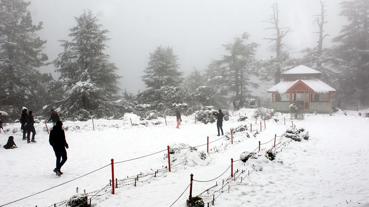
An advisory has been issued for Shimla, Chamba, Lahaul-Spiti, Kullu and Kinnaur districts, a government statement said. Shimla and nearby tourist spots Kufri and Narkanda experienced more snowfall in the past 24 hours, turning them even more picturesque.
As news of snowfall spread, tourists flocked to Shimla, which is known for its imperial grandeur of its buildings that were once institutions of power when the town served as the summer capital of British India, and its nearby destinations for enjoying snowy landscape.
Mercury in Drass, the second coldest inhabited place in the world, plunged 31 degrees below freezing point even as Kashmir continued to reel under intense cold wave conditions prevailing over the past two months, MET officials said on Monday.
Kashmir Valley, meanwhile, continued to reel under the intense cold wave conditions.
Kashmir is currently under the grip of 'Chillai-Kalan' – the 40-day harshest period of winter when the chances of snowfall are most frequent and maximum and the temperature drops considerably.
'Chillai-Kalan' ends on January 31, but the cold wave continues even after that in Kashmir. The 40-day period is followed by a 20-day long 'Chillai-Khurd' (small cold) and a 10-day long 'Chillai-Bachha' (baby cold).
Light rain/snow occurred at isolated places over Himachal Pradesh and Uttarakhand.
Rain/thundershowers occurred at a few places over Coastal Andhra Pradesh, Telangana and Rayalaseema and at isolated places over Chhattisgarh, Odisha, Sub-Himalayan West Bengal, Arunachal Pradesh, Assam and Meghalaya, Bihar, Tamil Nadu , Interior Karnataka and Kerala.
Heavy rainfall observed at isolated places over Telangana and Rayalaseema. Rainfall recorded (1 cm or more) at 0830 hrs IST of today is: Konijerla-8; Nalgonda and Nandigama- 5 each; Khammam and Kurnool-4 each; Kavali-3; Mahabubnagar and Rentachintala-2 each and Ongole, Anantapur, Kovilangulam and Kakinada-1 each.
Moderate fog observed at isolated places over Odisha and Uttarakhand at 0830 hours IST of today. Visibility: Jharsiguda and Pantnagar - 200 M each.
(with inputs from Indian Meteorological Department and IANS)
Join our official telegram channel (@nationalherald) and stay updated with the latest headlines