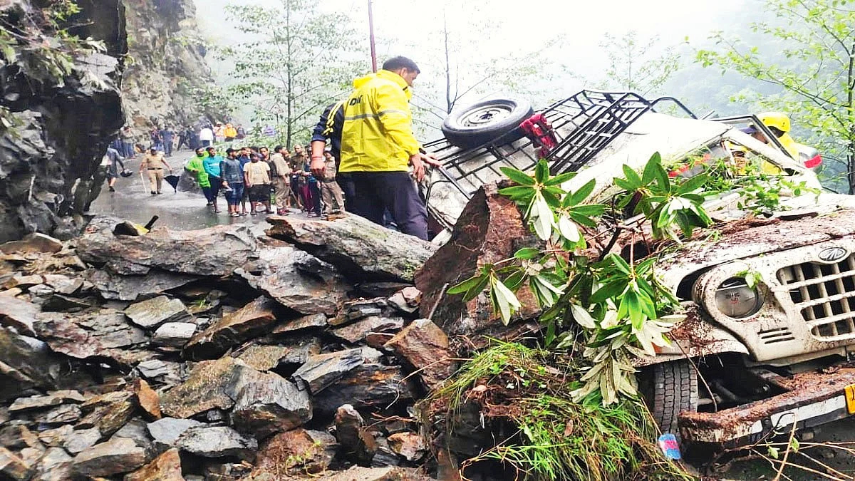
Uttarakhand, India’s landslide capital
From 216 in 2018 to 1,100 in 2023 to 2,946 in 2024! That’s the score

Landslides are no longer confined to the monsoon months. In the first three months of this year, Uttarakhand recorded as many as 1,000 landslides in which over 260 lives were lost. The extent of damage to homes, roads, public and private property is yet to be accurately assessed.
Indiscriminate felling of trees and unscientific cutting of hillsides to build and widen roads has taken a heavy toll. Fresh landslide zones have emerged on both sides of the Badrinath highway. Rudraprayag and Tehri have become particularly vulnerable and the very existence of Nainital, the state’s most popular tourist destination, is now threatened.
The Indian Space Research Organisation (ISRO) has compiled a Landslide Atlas of India, which analyses 147 districts across 17 states. All 13 districts of Uttarakhand feature in the atlas with the Uttarakhand State Disaster Management Authority confirming that over 25 new landslide and subsidence spots were found during this year’s monsoon.
As many as 203 landslide zones have been identified in Uttarakhand, which accounts for 3,594 km of our national highways. Of these, 60 are on the Dehradun–Pithoragarh route. The Kameda landslide zone near Gauchar has remained unresolved for three years, repeatedly damaging the Badrinath Highway. Umatta, near Karnaprayag, has made a bad situation worse — while last year saw minor debris, this year’s landslides struck a much larger stretch on both sides of the bridge and stream.
Uttarkashi, the gateway to Gangotri and Yamunotri, on the banks of the Bhagirathi, has also become vulnerable. A single landslide here puts all its inhabitants at risk.
The entire Varunaavat mountain range is highly sensitive and earthquake-prone. In 1991, an earthquake of the magnitude 6.1 on the Richter scale occurred here. Dense pine forests and the rising number of forest fires during the summer are adding to the risks. Deforestation and demolition of mountains for construction has weakened soil stability, causing even solid rock formations to collapse.
According to ISRO data, 12,319 landslides occurred in Uttarakhand between 1988 and 2023. In 2018, there were 216 landslides in the state, while in 2023, this number increased five-fold to 1,100. Landslide incidents also increased nearly four and a half times in 2023 compared to 2022. In 2024, 2,946 landslides were recorded, resulting in 67 deaths.
Nainital has witnessed massive landslides in Baliyanala, China Peak, Mall Road, Kailakhan, Thandi
Sadak, and Tiffintop. Residents and experts recall the 1880 landslide near Nainital that killed around 150 people when the town’s population was just 10,000. In response, the British administration banned new construction, grazing and gardening on Sher Ka Danda hill, and launched large-scale afforestation efforts.
Professor B.S. Kotlia, geologist at Kumaon University, attributes increased landslides and subsidence to the activation of a fault that runs between Nainital and Naini Lake. Unchecked construction and geological shifts are other contributing factors, he adds.
A 2018 study by Uttarakhand’s Disaster Management Department and the World Bank identified over 6,300 landslide-prone sites in the state. It found that large-scale development projects, involving mountain cutting and deforestation, are aggravating the problem. Around 25,000 trees were reportedly cut across 356 km of forest for concrete roads, grave enough for it to reach the National Green Tribunal — but only after the damage was done.
Trees are vital in preventing hill erosion and collapse. The indiscriminate felling of trees and blasting of hills has increased earthquake risks right up to Delhi and affected freshwater flows into the Yamuna. Despite this, construction continues apace on the Char Dham Pariyojana. The road project linking the pilgrimage sites of Badrinath, Kedarnath, Gangotri, and Yamunotri includes 15 major bridges, 101 smaller bridges, 3,596 culverts and 12 bypass roads.
A railway project from Rishikesh to Karnaprayag has also been approved, which will not only result in largescale deforestation and adversely impact wildlife but also see more tunnels and bridges being cut through the mountains. This year, the crisis is particularly acute because the rainy season is expected to extend until December.
If our planners and policy-makers haven’t learnt from the extreme weather events of recent months, with irreplaceable loss of life, property and revenue, there’s little hope for the hills.
Follow us on: Facebook, Twitter, Google News, Instagram
Join our official telegram channel (@nationalherald) and stay updated with the latest headlines
