Ports across Coromandel coast on alert as Cyclone Montha nears Andhra coast
Several coastal towns report waterlogging and power outages as authorities move thousands from low-lying areas to temporary shelters


In its latest hourly update on the landfall of Cyclone Montha ('fragrant flower' in Thai), the IMD (India Meteorological Department) stated that the severe cyclonic storm moved north-northwestwards and at 3.30 pm today, 28 October, and lay about 60 km south-southeast of Machilipatnam, 140 km south-southeast of Kakinada (Andhra Pradesh), 240 km south-southwest of Visakhapatnam (Andhra Pradesh), and 480 km south-southwest of Gopalpur (Odisha).
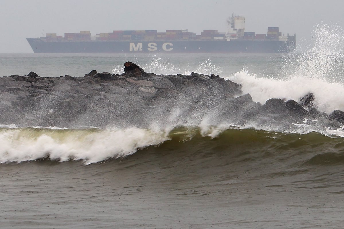
It is expected to cross the Andhra Pradesh coast between Machilipatnam and Kalingapatnam around Kakinada during evening or night today as a severe cyclonic storm, with maximum sustained wind speed of 90–100 kmph gusting to 110 kmph.
“The SCS Montha moved north-northwestwards and is likely to cross the Andhra Pradesh coast around Kakinada during the evening or night of 28 October as a severe cyclonic storm, with maximum sustained wind speed of 90–100 kmph gusting to 110 kmph,” the IMD said on X.
As a precaution, all 32 flights operating from Visakhapatnam Airport were cancelled on Tuesday. “Actually, we are operating 30 to 32 movements daily, both domestic and international. Today, all those flights are cancelled,” Visakhapatnam Airport director N. Purushottam told PTI, adding that the airport has implemented Airports Authority of India (AAI) cyclone protocols, covering pre- and post-storm safety phases.
At Vijayawada Airport, 16 flights were cancelled, though five managed to operate, airport director Lakshmikanth Reddy said. “The airlines have taken a decision to suspend operations for today. Clarity on tomorrow’s flights may emerge by evening,” he added.

According to the IMD, extremely heavy rainfall — of 21 cm or more in 24 hours — was recorded at isolated places over coastal Andhra Pradesh and Yanam, while heavy rainfall (7–11 cm) occurred in Rayalaseema, Kerala, Mahe, Odisha, Chhattisgarh, East Madhya Pradesh, Madhya Maharashtra, and Tamil Nadu.
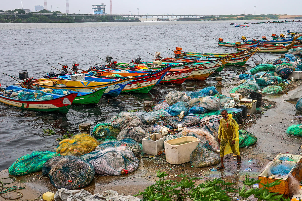
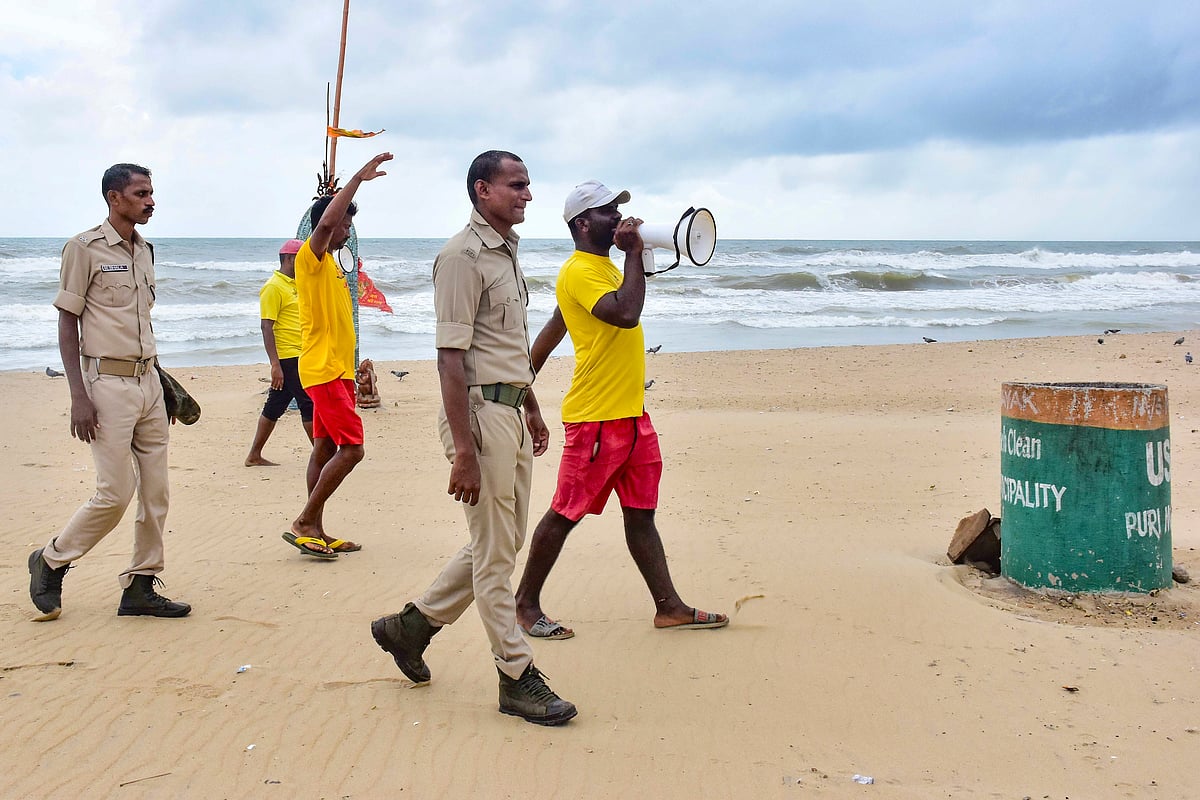
Several coastal towns reported waterlogging and power outages as authorities moved thousands of residents from low-lying areas to temporary shelters.
The IMD issued an orange alert for several Odisha districts, forecasting heavy to very heavy rainfall at isolated places in Nawarangpur, Kalahandi, Kandhamal, Nayagarh, Khordha and Puri. Surface winds reaching 50–60 kmph, gusting to 70 kmph, are likely in Ganjam, Kandhamal, Boudh, Bolangir, and Nuapada districts.
A yellow alert has been issued for Angul, Dhenkanal, Cuttack, Jagatsinghpur, Kendrapara, Jajpur, Keonjhar, Bhadrak, Balasore, Mayurbhanj, Sambalpur, Deogarh, Jharsuguda, Sundargarh, Sonepur, and Bargarh, with wind speeds expected to reach 40–50 kmph, gusting up to 60 kmph.
Authorities in both Andhra Pradesh and Odisha have deployed disaster response teams, and control rooms have been activated in all coastal districts. Fishermen have been advised not to venture into the sea until at least 29 October, with rough conditions expected to persist for 24 more hours post-landfall.
Officials said the cyclone would bring extremely heavy rainfall to northern coastal Andhra Pradesh and adjoining southern Odisha before gradually weakening as it moves inland.
Join our official telegram channel (@nationalherald) and stay updated with the latest headlines