World
Nepal lost critical flood-monitoring stations in Bhote Koshi disaster
Government assessment says destroyed monitoring stations show the flood’s extreme intensity and hinder real-time monitoring
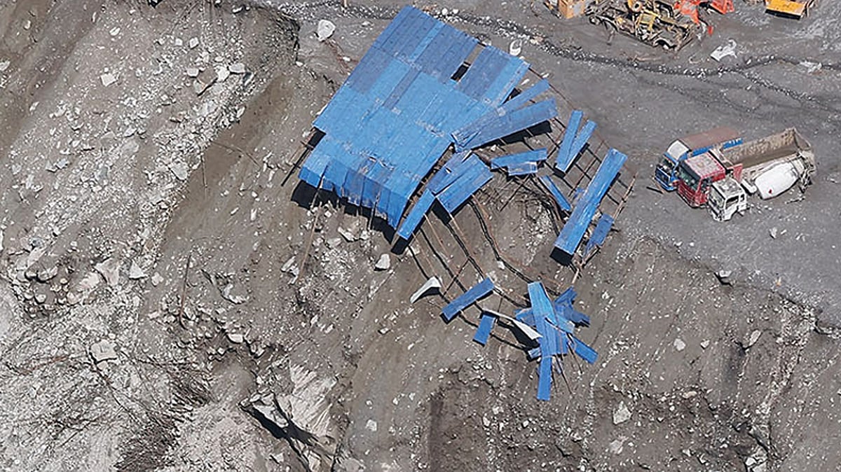
Nepal’s ability to monitor dangerous river levels in real time was severely disrupted when a devastating flood on 26 August destroyed or disabled several critical hydrological monitoring stations along the Bhote Koshi-Trishuli river corridor, leaving authorities with limited data as an exceptionally fast-moving flood wave surged downstream.
The scale of the damage has raised fresh concerns over Nepal’s flood-warning capabilities in one of the country’s most vulnerable river systems, where extreme events can develop and propagate within minutes.
According to Assessment Report II, prepared by the Centre of Hydrology and Water Resources Research (CHWRR) under the Water and Energy Commission Secretariat of the Government of Nepal, several key monitoring stations were either washed away or rendered inoperable during the flood.
The affected stations included those at Rasuwagadhi (Timure), Syaphru Besi, Betrawati and Phurke Khola in Malekhu. The stations are strategically located along the Bhote Koshi and downstream Trishuli river corridors and are important for tracking changes in river levels and providing information needed for flood warnings.
At Rasuwagadhi in Timure, one of the critical monitoring points along the Bhote Koshi, data transmission stopped at 8:40 am. The station's final recorded water level was 3.8 metres before the monitoring structure was washed away by the flood.
A similar situation occurred at Syaphru Besi, where transmission ceased at 8:50 am, with the last recorded water level standing at 1.62 metres. The monitoring station was subsequently swept away by the floodwaters of the Bhote Koshi, a transboundary river flowing between Nepal and China.
Downstream, the Betrawati station on the Trishuli River stopped transmitting at 9:20 am, after recording a water level of 3.55 metres. The station was later washed away as the flood intensified.
The monitoring station at Phurke Khola in Malekhu, Dhading district, was also destroyed after the water level crossed the danger threshold at 11:43 a.m. The floodwaters also swept away the bridge associated with the monitoring site.
The government assessment said the destruction of the stations demonstrated the extreme intensity of the flood event and created major difficulties for monitoring and analysing the flood in real time.
The loss of the monitoring network was particularly serious because the flood wave travelled at an extraordinary speed, leaving authorities with very little time to observe its development and issue warnings.
The assessment estimated that the flood wave travelled approximately 22 kilometres from its source area to the Rasuwagadhi border in around seven minutes. This corresponds to an estimated average speed of about 188 kilometres per hour.
Such rapid propagation meant that even a functioning monitoring station would have had only a very short window to capture and transmit information before the flood wave moved downstream.
Sauharda Joshi, a hydrologist at the Department of Hydrology and Meteorology who was involved in preparing the assessment, said the stations were unable to record the full magnitude of the flood because of the extraordinary velocity of the water.
“It is because of the massive flood that flowed at too high a velocity,” Joshi said.
The destruction of the stations meant that the exact peak flood levels could not be captured at several locations.
Following the disaster, authorities have begun looking for alternative ways to monitor river conditions in the affected areas.
A CCTV camera has been installed at Timure in Rasuwagadhi to provide visual monitoring of the river. Authorities have also begun the process of installing flood-monitoring systems at Betrawati and Phurke Khola.
According to Joshi, locations for the new systems have already been identified following field visits.
“The locations for installing the flood-monitoring systems have been identified at these two locations following field visits,” he said.
However, the replacement systems are not yet sufficient to restore the monitoring capacity that existed before the disaster.
Joshi said the latest damage has left a significant gap in the flood-warning network along the Bhote Koshi and Trishuli rivers.
“That's why the immediate risk is that we are without a flood-warning system in the Bhote Koshi and Trishuli,” he said.
The destruction of multiple stations has also prompted discussions about how Nepal can make its hydrological monitoring infrastructure more resilient to extreme floods.
Officials are considering whether monitoring should be carried out through two separate systems at each critical location—one positioned closer to the river and another at a safer, higher elevation.
Such a configuration would provide redundancy. If a monitoring station located near the river were destroyed by floodwaters, the elevated system could continue transmitting information about river conditions.
The 26 August disaster has therefore highlighted not only the destructive power of extreme flooding but also vulnerabilities in Nepal’s existing flood-monitoring infrastructure.
With the Bhote Koshi-Trishuli flood wave moving downstream at an exceptionally high speed, the loss of real-time monitoring stations severely limited the ability of authorities to capture the event as it unfolded.
The government assessment has underscored the need for more robust, strategically positioned and redundant monitoring systems, particularly in high-risk river corridors where a matter of minutes can determine whether timely flood warnings reach downstream communities.
With IANS inputs
Join our official telegram channel (@nationalherald) and stay updated with the latest headlines