


Explained: Why Mumbai is receiving record rainfall in an El Niño year
Experts say while El Niño delayed the monsoon's arrival, global warming is making rainfall more intense once weather systems become active
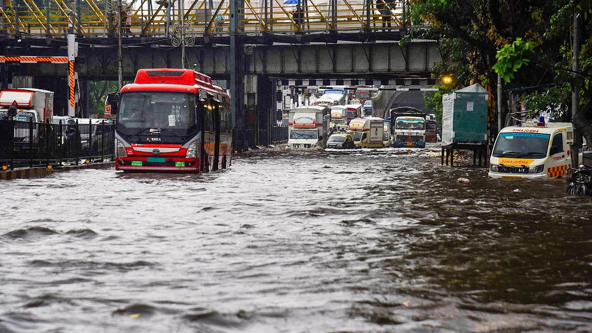


Mumbai has received exceptionally heavy rainfall in the first week of July despite the continued influence of El Niño, with scientists saying the phenomenon is consistent with a broader shift in monsoon behaviour driven by global warming.
According to the India Meteorological Department (IMD), its Colaba observatory recorded 791 mm of rainfall between 1 July and 7 July, surpassing its climatological average for the entire month of July of 768.5 mm. The Santacruz observatory recorded 879 mm during the same period, against its monthly average of 919.9 mm.
The heavy rainfall has occurred even as India continues to experience El Niño conditions, characterised by unusually warm sea surface temperatures in the central and eastern Pacific Ocean. The climate phenomenon typically delays the onset of the southwest monsoon and can influence its overall activity.
Although the monsoon reached Mumbai nearly two weeks later than usual, it entered an active phase by the end of June, bringing intense rainfall across the city and several parts of coastal Maharashtra.
Global warming changing rainfall patterns
Scientists said there was no contradiction between the occurrence of heavy rainfall during an El Niño year.
While El Niño continues to influence the timing and strength of the monsoon, they said global warming is increasingly altering the nature of rainfall, making it more erratic and intense once weather systems become active.
The trend is also reflected in Mumbai's long-term rainfall data. Between 1981 and 2000, the city recorded an average annual rainfall of 2,325.8 mm. That figure rose to 2,672.7 mm during 2001–2024, an increase of 346.9 mm, or nearly 15 per cent.
Climate scientists said a warmer atmosphere and rapidly warming oceans allow the air to retain more moisture. As a result, rainfall is increasingly concentrated into short-duration, high-intensity spells instead of being spread over several days, increasing the risk of flash floods and overwhelming urban drainage systems.
"During El Niño years, the number of rainy days is lower. But we know that the character of the monsoon has changed permanently due to global warming. Rainfall now tends to occur in short-duration, high-intensity spells, whether there is an El Niño or not," said K. J. Ramesh.
Raghu Murtugudde said several weather systems had combined to produce the exceptionally heavy rainfall.
He said the delayed onset of the monsoon could partly be explained by El Niño, but global warming-induced changes over West Asia and shifts in Arabian Sea winds had also contributed. Moisture from both the Arabian Sea and the Bay of Bengal, along with a developing low-pressure system over the Bay of Bengal and the orographic effect of the Western Ghats, had together intensified rainfall over Mumbai.
Murtugudde added that El Niño could no longer be viewed in isolation from global warming, as the two increasingly interact to shape monsoon behaviour.
Rainfall expected to ease
IMD data showed that in the 24 hours ending Tuesday morning, the Santacruz observatory recorded 94 mm of rainfall, while the Colaba observatory recorded 90 mm. It was the first time in the past five days that rainfall at both observatories remained below the three-digit mark.
According to the Brihanmumbai Municipal Corporation, the western suburbs received 78 mm of rainfall during the same period, followed by 77 mm in the eastern suburbs and 46 mm in the island city.
The IMD has placed Mumbai under a yellow alert. However, its five-day forecast indicates that Mumbai and neighbouring Thane are likely to receive only light rainfall over the coming week, with no heavy rainfall warning currently in place.
Join our official telegram channel (@nationalherald) and stay updated with the latest headlines