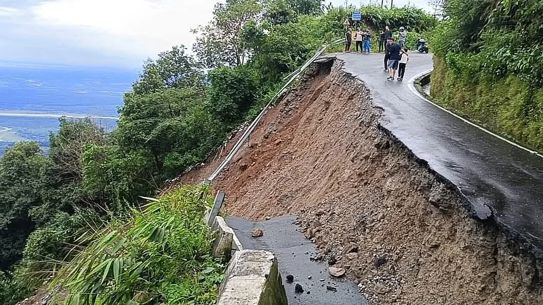
‘Saturated’ Himalayan slopes cause of Bengal-Sikkim landslides, say GSI
The 4 October “extreme downpour” cost Darjeeling 28 lives, even as 500 tourists were rescued

The Geological Survey of India (GSI) affirmed it had issued a high-risk landslide forecast for Darjeeling on 4 October, just hours before relentless rainfall lashed the region and triggered deadly landslides. GSI officials explained the disaster was “a result of heavy downpour that significantly weakened the natural stability of the Himalayan terrain”.
Dr Saibal Ghosh, deputy director general of the GSI, stated, “We had provided a landslide forecast in Darjeeling Pulbazar, Jorebunglow Sukiapokhri, Kurseong, Mirik and Rangli Rangliot blocks of Darjeeling district in the afternoon of 4 October. It was an operational bulletin issued around 2.15 p.m.”
He emphasised that daily bulletins are issued for four vulnerable districts — Darjeeling, Kalimpong, Nilgiris and Rudraprayag — with the alerts available to the public on the GSI’s 'Bhusanket' web portal and the 'Bhooskhalan' mobile app.
The 4 October warning was based on meteorological forecasts of significant rainfall, saturated soil conditions and ongoing vulnerability after months of monsoon precipitation, Ghosh explained, saying, “In the Himalayas, the monsoon period is from June to October. During this time, the risk of landslides is always high because of the volume of rainfall. But October rainfall is especially dangerous, because the soil is already fully saturated.”
This year’s rainfall — an astounding 393 mm in Kurseong over 4–5 October — was followed by what he described as an “extreme downpour”.
“Basically, rainfall between 130 mm and 150 mm in a single day can trigger a landslide. If such heavy rainfall occurs in October, then it is very dangerous for places like the Himalayas. Because after four months of monsoon rains, the soil is already saturated. Even moderate rain can trigger major slides, and here we had an extreme downpour,” Ghosh said.
He added, “The rainfall continued from 4 October night till 5 October morning. Had the downpour continued for another day, the devastation would have been much more.”
Darjeeling’s vulnerability is not new — October has historically seen some of the region’s deadliest landslides.
Ghosh specifically referenced the catastrophic event of October 1968, when three days of rain (1,121 mm total, 499 mm in one day) led to over 677 deaths, floods, landslides and a year-long blockage of vital roads. He stressed that “several other major landslide events have also occurred in subsequent years, including in 1978, 1979, 1981, 1993, 1998, 2001, 2006, 2007, 2015 and 2023”.
Explaining the science, Ghosh said, “Technically, landslides are gravitational processes. Hillsides are naturally prone to collapse, but whether a slope will fail depends on both intrinsic geological conditions and external triggers like rainfall, earthquakes — or human activity.”
In the Himalayas, this is exacerbated by the “region’s complex terrain, steep slopes, and fractured rock formations”, which make the landscape highly susceptible to collapse, requiring little more than “intense or prolonged rainfall” as a trigger.
Ghosh also expressed concern over “growing human interference on unstable slopes,” criticising “homes built across drainage channels, blocking natural water paths”. He urged, “The state must step in with strict regulations.”
Despite advancements in early warning and real-time public bulletins, the Darjeeling landslide disaster shows that risks persist in the Himalayas, especially during saturation periods in October, when even moderate rainfall becomes a major threat to life and infrastructure — and it would seem neither citizens, nor authorities had precautions in mind.
With PTI inputs
Follow us on: Facebook, Twitter, Google News, Instagram
Join our official telegram channel (@nationalherald) and stay updated with the latest headlines
