Char Dham of the Great Himalayan National Park: the Parbati River
In the late 1990s, the NHPC had proposed a huge dam to impound the waters of the Parbati and generate 800 MW of power. Fortunately, it was refused environmental clearance


The Parbati is the best known and biggest of the four Great Himalayan National Park rivers, meeting the Beas at Bhunter, just below Kullu. It is the only one that does not originate from a glacier — its womb is the huge, forbidding Mantalai lake at 14,000 feet, at the foot of the Pin Parbat pass which divides the Spiti and Kullu valleys.
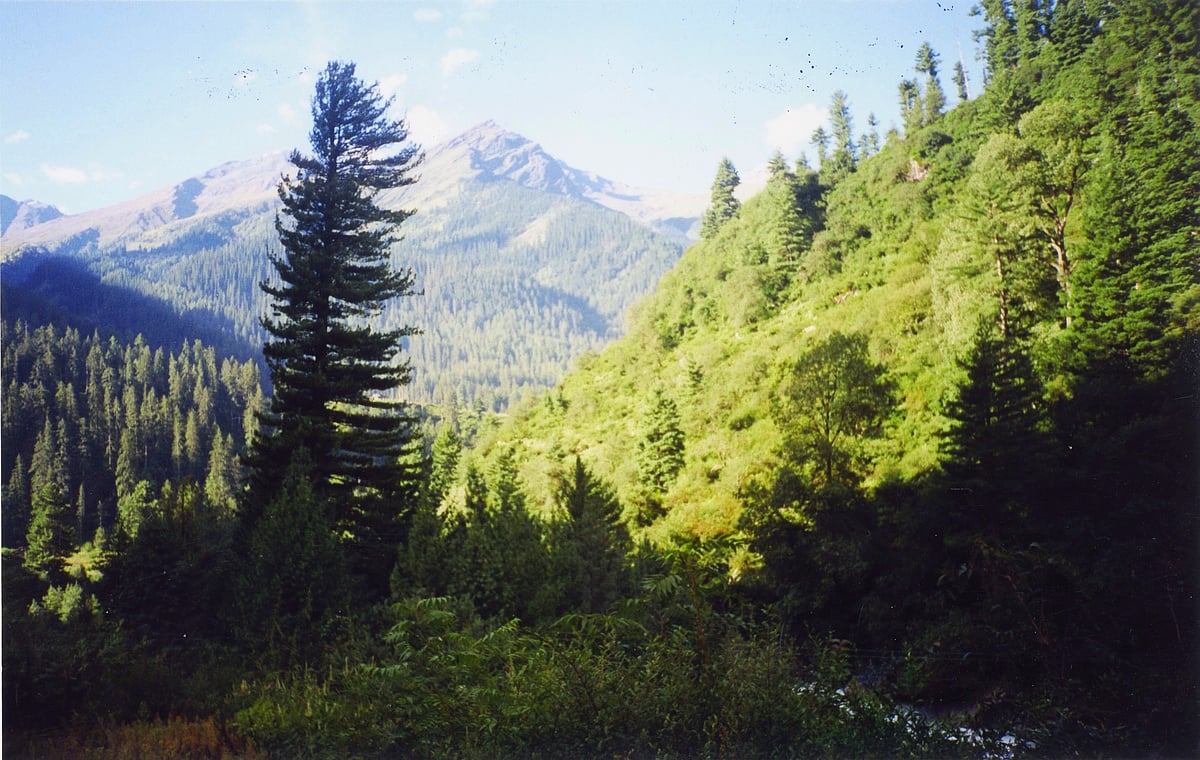
The Parbati valley, one of the two best known valleys in the state (along with Sangla valley in Kinnaur), is totally uninhabited for most of its length, and shrouded in mystery, myth and wonder; a number of trekkers have disappeared in its remote fastness, never to be heard of again.
At the foot of the 120 km-valley are the small settlements of Kasol and Manikaran, hubs for both drug and religious tourism (Manikaran has the famous hot springs and gurudwara), attracting thousands of tourists, including from Israel and Russia. These, however, are add-on aberrations introduced by man, the real Parbati valley upstream of these urbanised scars is quite different, a natural Eden of resplendent vegetation, wildlife, perennial streams, and high mountains.
The trek to Mantalai takes three to four days and begins at Gwacha, about 15 km beyond Manikaran where the Tosh Nullah joins the river. The track winds upwards, past Pulga (there is an Italian pizzeria here!), Nagthan (the last village), Rudranag (so named because of a waterfall shaped like a serpent below which the god Ganesh is believed to have meditated), Ishidwara, which actually had a restaurant run by an intrepid Sharmaji from Palampur when we went up there — I fondly hope he’s still there!
About 10 km later is the famous Kheer Ganga (2,900 m), the USP of which is a pool fed by a hot-water spring, once pristine and unsullied but now overrun with dhabas and serais. Fortunately, the debasing tentacle of tourism ends here, and beyond is the realm of the Gujjar, gaddi and the brown bear. One can camp here for the first night, or move up another five kms to Mandron on the left bank of the river.
We camped at the latter spot and met a Gujjar, Lal Hussain, who had made his semi-permanent camp here, along with his four wives, 25 buffaloes and a hidden hoard about which he would tell us nothing! He is the last of a disappearing breed of hardy pastoralists, threatened by reduced ranges for their cattle, the inroads of development, and a new generation which craves the smart phone, TV, and an urban lifestyle.
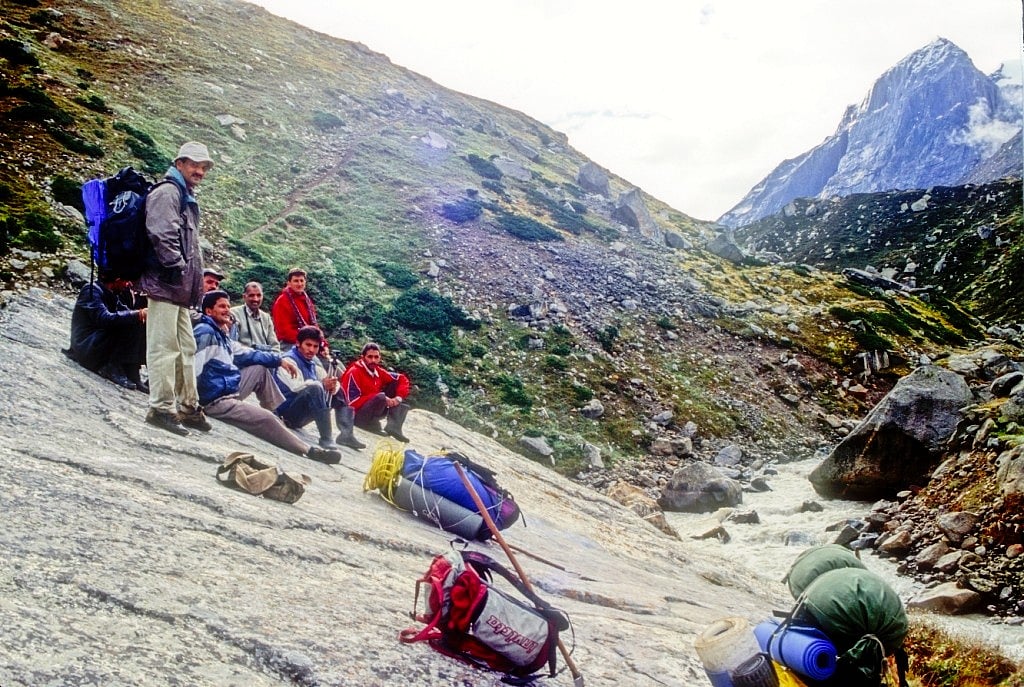
The first hair-raising experience is encountered on the second day at Nichidwar — crossing the river on a wire basket suspended over the waters on a cable and pulled by ropes to the other side. Definitely not for the faint hearted.
About six km further on, a deep gorge meets the Parbati on its right bank: this is Dibbi Bokri and attached to it is a fascinating tale of an Englishman who discovered emeralds in the gorge, killed off his Gorkha labourers one night, and disappeared with the jewels, never to be heard of again.
In the late 1990s, the National Hydroelectric Power Corporation (NHPC) had proposed a huge dam below Dibbi Bokri to impound the waters of the Parbati and generate 800 MW of power — phase I of the Parbati project. This would have been an environmental disaster of unimaginable proportions; fortunately, it was refused environmental clearance.
There were apprehensions that at some later date, the idea would be revived, but in 2010, the Himachal Pradesh government notified the entire area above Pulga right up to the base of the Pin Parbat as the Kheer Ganga National Park, so hopefully this lovely landscape has been saved for posterity.
By the evening of the second day, after having covered 25 km, one reaches Pandupul (3,700 m), where the river has to be crossed once again to the right bank. But this time over one immense, monolithic boulder the size of a house which straddles the river, which is a gushing torrent about 10 m wide at this point. Legend has it that the huge boulder was put there by Bhim when the Pandavas came here during their exile, hence the name of the place. We silently thanked that brave warrior, for having spared us another wire basket crossing!
The third day’s trek is a gentle, 16 km walk up the valley which at this point is about a kilometre wide, with the adolescent Parbati happily gurgling down its left side. One ambles through a thickly carpeted pasture, knee deep in multi-hued flowers, flanked on both sides by towering snow covered peaks from which tumble small streams, impatient to join the Parbati on its way down to the Beas, crisscrossing the pasture.
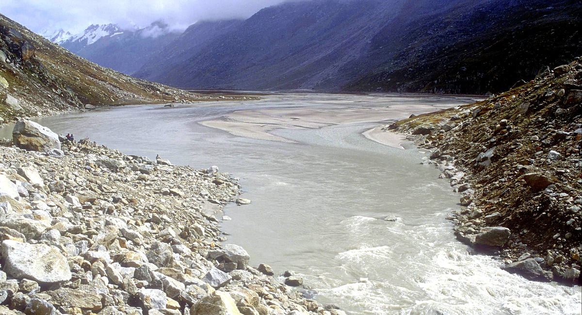
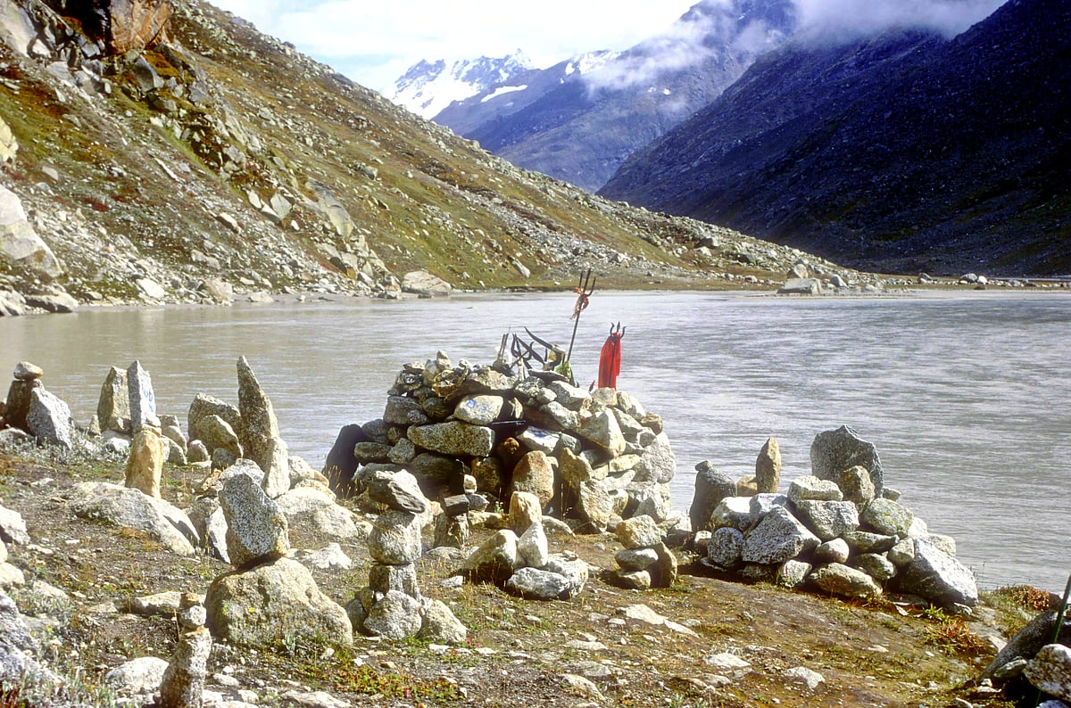
After about 14 km, the valley widens out quite a bit and the river now distributes itself into a score of water courses, almost like a delta. Negotiating them is no problem, and after another kilometre or so, one is confronted with a huge rockfall, 100 m high, which blocks the valley. This is the appropriately named Shahidwar; the Parbati has carved out a passage for itself on the right, but we had to clamber over the mound of rocks. Cresting it, we came face to face with the magnificent Mantalai lake, the womb from which the Parbati takes birth.
The landscape here, at 4,100 meters, is awesome. The lake is huge, nestled in an elliptical basin about 2 km long and half-a-kilometre wide, in a southeast/northwest alignment. It is a pure glacial lake, completely enclosed by towering mountains from whose glaciers and snowfields innumerable streams and run-offs feed it. Little mounds of rocks, called jognis, are scattered all around on its banks — these are sacred spots where locals come to pray and plant colourful flags; we did so too: in these rugged regions, it is better to have the gods on your side.
There is only one small opening on the northwest side, though which the infant Parbati gleefully escapes its forbidding cradle in a frothing gush of water. The landscape is majestic and hypnotic, but Mantalai is not a pretty lake like Khajjiar, or scenic like Chandratal, or gentle like Renuka. Mantalai is, instead, imperious in its grandeur, confident in its silence, and arrogant in its ruggedness. It commands respect, not love.
Beyond it, another two days of hard and dangerous trekking, and 1,500 m higher up is the Pin Parbat pass, and beyond that Pin Valley National Park. This is the realm of the wind, ice and snow and the primeval forces of creation rule here. Man is an intruder here who the gods tolerate when they are well inclined, and who perishes if they are not so minded. He should pass through with reverence, his head bowed in humble respect. May it be so for eternity.
All photos by author
Avay Shukla is a retired IAS officer and author of The Deputy Commissioner’s Dog and Other Colleagues. He blogs at avayshukla.blogspot.com
Join our official telegram channel (@nationalherald) and stay updated with the latest headlines