Nation
Uttarkashi flash flood: Experts differ on cloudburst as cause for disaster
Geologists await satellite images, say it could be an ice chunk falling, a rockfall or a huge landslide which mobilised the moraine deposits in the narrow stream
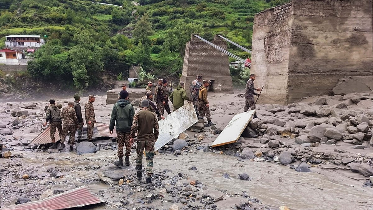
A cloudburst in the upper catchment of the Kheer Ganga river is widely believed to have triggered the flash flood on 5 August in Uttarkashi's Dharali, but experts feel the amount of rain the Uttarkashi district received was not enough for it to be termed a "cloudburst".
"Data available with us does not reflect the occurrence of a cloudburst," according to Rohit Thapliyal, a scientist with the India Meteorological Department (IMD).
He said Uttarkashi received only 27 mm of rain on Tuesday, 5 August, "which is too little for a cloudburst or flash flood of such devastating intensity".
Asked what could have been the reason, he said it was a subject of research. "Only after detailed research can anything be definitively said about what led to the flash flood," he said.
A cloudburst, among the most devastating natural disasters in the Indian Himalayas, causes an enormous amount of rainfall across a limited area within an extremely short span of time.
According to the IMD, rain falling at a rate of over 100 mm an hour with strong winds and lightning across 20-30 square km of area is termed a cloudburst.
However, in a 2023 paper, researchers from IIT-Jammu and National Institute of Hydrology, Roorkee, define cloudburst as a "sudden downpour of rainfall in a range of 100-250 mm an hour in a short span covering a smaller spatial extent similar to one square km".
It is not just the amount of rainfall. D.P. Dobhal, a former scientist at the Wadia Institute of Himalayan Geology, Dehradun, also said the possibility of a cloudburst at an altitude like that is too thin.
"The heights from where the sludge came rushing down the slopes fall in the Alpine region where the possibility of a cloudburst is minimal," he said.
"Most likely it was an ice chunk falling, a rockfall or a huge landslide which mobilised the moraine deposits in the narrow stream, causing the flash flood," the former scientist explained.
Satellite images have been requested from the Indian Space Research Organisation to clearly ascertain the causes of the Uttarkashi disaster. Officials said that the Uttarakhand Space Application Centre has issued a request letter to ISRO in this matter.
A study published last month in the Journal of the Geological Society of India has confirmed a sharp rise in extreme rainfall and surface runoff events in Uttarakhand after 2010.
The research, led by HNB Garhwal University Professor Y.P. Sundriyal, shows that while 1998-2009 saw warming and low rainfall, the trend reversed post-2010, with central and western Uttarakhand witnessing more extreme precipitation events.
The state's geology compounds its risk. Steep slopes, young and fragile formations prone to erosion and tectonic faults such as the Main Central Thrust make the terrain unstable. The orographic effect of the Himalayas forces moist air upwards, leading to intense localised rainfall, while unstable slopes magnify the risk of landslides and flash floods.
A November 2023 study published in the Natural Hazards journal, analysing disaster data between 2020 and 2023, recorded 183 incidents in Uttarakhand during the monsoon months alone. Landslides accounted for 34.4 per cent of these, flash floods 26.5 per cent and cloudbursts 14 per cent.
The Centre for Science and Environment's Atlas on Weather Disasters shows that between January 2022 and March 2025, the 13 Himalayan states and Union Territories reported extreme weather events on 822 days, claiming 2,863 lives.
Experts say these natural factors are worsened by human activity. Unregulated road-building, deforestation and construction of tourism infrastructure and settlements on unstable slopes or river banks have increased disaster risk.
Join our official telegram channel (@nationalherald) and stay updated with the latest headlines