Nation
Cyclone Senyar likely in 48 hours; southern states brace for heavy rain
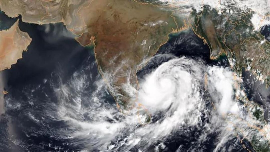
IMD’s morning satellite scans show intense convection over the south Andaman Sea, the Strait of Malacca and nearby waters
The India Meteorological Department (IMD) on Tuesday painted an evocative picture of a brooding weather system gathering strength far to the east, announcing that a well-marked low-pressure area lingering over Malaysia and the adjoining Strait of Malacca is poised to evolve into a cyclonic storm over the south Bay of Bengal within the next 48 hours, the India Today reported.
The nascent system, drifting west-northwestwards like a slow-moving leviathan, is expected to consolidate into a depression over the south Andaman Sea within the next day. IMD’s early-morning satellite scans reveal dramatic scenes in the sky — towering, highly charged cloud bands pulsing with intense to very intense convection across the south Andaman Sea, the Strait of Malacca and surrounding waters. Winds are currently sweeping through the region at 15–20 knots, surging to 30 knots in gusts, with the seas heaving in moderate unrest.
Adding to the evolving complexity of the atmosphere, an upper-air cyclonic circulation swirling over Comorin and its neighbouring stretches is tipped to spawn yet another low-pressure area over the southwest Bay of Bengal and Sri Lanka around 25 November — a system that may grow in strength as the days unfold.
Should the primary system attain cyclonic intensity, it will be christened ‘Senyar’, a name meaning “lion” offered by the United Arab Emirates in the North Indian Ocean’s rotating naming roster. In keeping with IMD protocol, the christening will occur only when the disturbance matures into a cyclonic storm — once a deep depression crosses the threshold of strength.
As the brewing system draws breath over warm tropical waters, IMD has unfurled an expansive rain forecast for the southern peninsula. Tamil Nadu is expected to be drenched by heavy rainfall from 25 to 27 November, with episodes of very heavy rain on 24 November and again from 28 to 30 November.
Kerala and Mahe, too, stand under darkening skies, likely to receive heavy showers from 24 to 26 November, while Lakshadweep may be lashed by downpours on 24 November.
The Andaman and Nicobar Islands — closest to the churning system — are forecast to witness heavy rainfall on 25 and 29 November, punctuated by very heavy spells between 26 and 28 November. Coastal Andhra Pradesh and Yanam may not be spared either, with heavy rain expected on 29 November, intensifying into very heavy showers on 30 November.
Thunderstorms, vivid with lightning and occasionally accompanied by gusty winds reaching 40–50 kmph, are likely to dance across wide swathes of the region — over Tamil Nadu from 24 to 28 November; Kerala and Mahe from 24 to 26 November; Lakshadweep on 24 November; and Coastal Andhra Pradesh and Yanam on 27 and 28 November. The Andaman and Nicobar archipelago may be rattled by thunderstorms and brisk winds throughout the next six days.
As the Bay of Bengal stirs once more with monsoonal drama, the southern states watch the horizon, bracing for the roar of a storm that may soon be named Senyar, the lion of the season.
Join our official telegram channel (@nationalherald) and stay updated with the latest headlines