Nation
Supreme Court nod to Aravalli definition despite own panel’s objections
A Central Empowered Committee distanced itself from ministry’s 100-metre proposal as amicus warned it could fragment the hill range and open vast tracts to mining
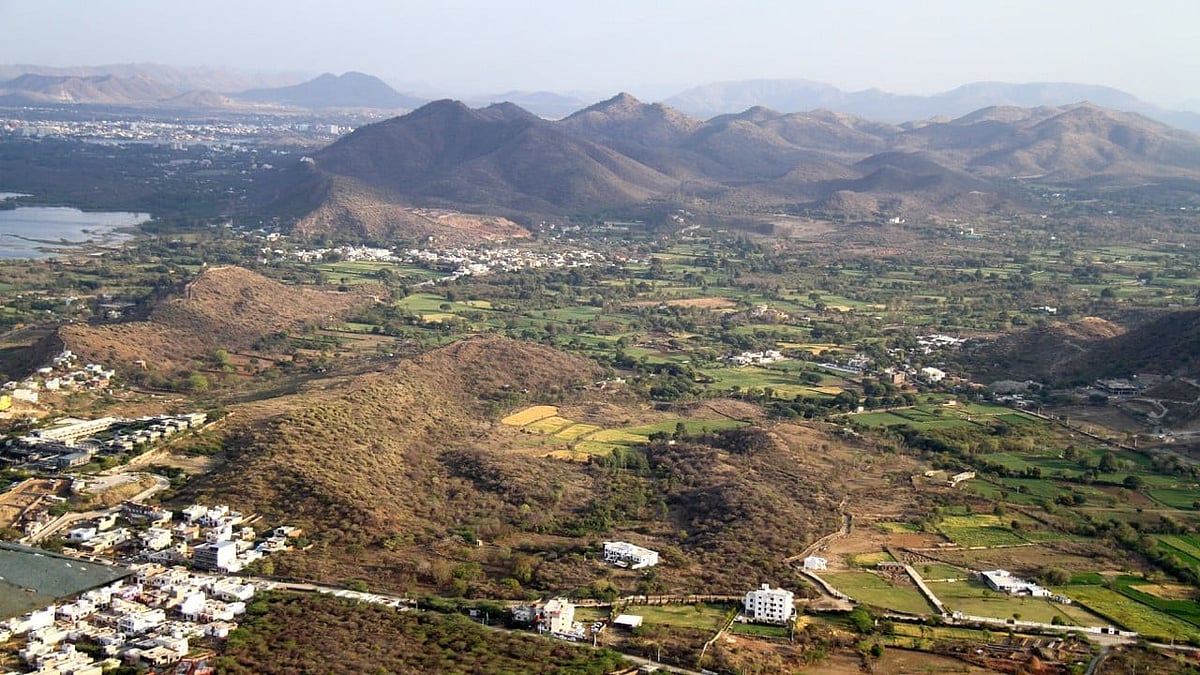
The Supreme Court’s acceptance of a new 100-metre definition for the Aravalli hill range has raised fresh questions about the process followed by the Union environment ministry and the potential ecological impact of the decision.
The Indian Express reported that on 13 October, the Ministry of Environment, Forest and Climate Change (MoEF&CC) proposed to the Supreme Court that only areas rising 100 metres above the surrounding terrain should qualify as Aravallis. A day later, the court’s Central Empowered Committee (CEC) wrote to the amicus curiae assisting the bench to clarify that it had neither examined nor approved the recommendation.
Despite this, on 20 November, the apex court accepted the ministry’s proposal.
The CEC, constituted by the Supreme Court in 2002 to oversee compliance with its orders on forests and the environment, has consistently favoured a broader definition prepared by the Forest Survey of India (FSI). In a letter dated 14 October, reviewed by The Indian Express, CEC chairman Siddhant Das said the FSI’s approach should be adopted “to ensure the protection and conservation of the ecology of the Aravalli Hills and its range”.
Under the FSI’s mapping, 40,481 sq km across 15 districts of Rajasthan are identified as Aravallis, based on elevation and a minimum slope of three degrees. This definition includes lower hills and hillocks, which scientists say play a critical role as wind barriers and ecological buffers. The exercise was undertaken by the FSI after it was commissioned by the CEC under a Supreme Court order in 2010.
The CEC also objected to the manner in which its views were represented before the court. In its 14 October letter, Das said draft minutes of a key 3 October meeting of a ministry-appointed committee were never shared with the CEC for examination. “No examination of the report prepared by MoEF&CC has been done by the CEC,” the letter stated, adding that the views attributed to the committee in the ministry’s affidavit were those of an individual member, Dr J R Bhatt, and not of the CEC as a body. The report submitted to the court was unsigned.
The amicus curiae, K Parmeshwar, also strongly opposed the 100-metre definition in a presentation to the court titled Implications and pitfalls of the new definition of Aravalli Hill and Ranges. Drawing extensively on FSI material, he argued that the new yardstick would undermine the integrity of the Aravallis as a continuous geographical feature.
“The integrity of the Aravalli as a geographical feature is lost due to this definition,” the presentation said, warning that it would fragment the range and fail to conserve it. Parmeshwar concluded that the ministry’s approach was “vague and cannot be accepted”.
Published: 24 Dec 2025, 8:57 AM IST
Using FSI maps, the amicus explained that numerous hillocks lie within the Aravalli boundary under the existing definition. If the 100-metre criterion were applied, many of these would no longer be recognised as part of the range and could be opened up for mining. Such an outcome, he cautioned, would have severe ecological consequences, including accelerating the eastward spread of the Thar Desert.
The Indian Express news report added that the controversy has also brought internal assessments by the FSI into focus. While the FSI said in a social media post that it had not conducted any formal study claiming that 90 per cent of Aravalli hills would be left unprotected, an internal assessment cited earlier by The Indian Express suggested otherwise. According to that assessment, the 100-metre definition would exclude 91.3 per cent of 12,081 Aravalli hills that are 20 metres or higher across 15 districts of Rajasthan. If all 1,18,575 recorded Aravalli hills are considered, more than 99 per cent would fall outside the new threshold.
Environment minister Bhupender Yadav has sought to allay concerns, stating on Monday that mining is permitted in only 0.19 per cent of the Aravalli range, covering about 278 sq km. However, ministry data shows that this figure represents the total area already under mining across Rajasthan, Gujarat and Haryana, not the potential area that could become available if lower hill segments are excluded from protection.
The ministry has yet to clarify how future mining or development in these lower reaches will be regulated under the new definition. It has also said that the exact extent of land covered by the 100-metre criterion will be known only after ground demarcation is completed, raising questions about how assurances were given to the court that the revised formula would protect more area than the existing FSI definition.
With the CEC maintaining that the FSI’s broader, terrain-based approach should prevail, the debate over how India defines and protects one of its oldest mountain ranges is far from settled.
Published: 24 Dec 2025, 8:57 AM IST
Join our official telegram channel (@nationalherald) and stay updated with the latest headlines
Published: 24 Dec 2025, 8:57 AM IST