Nation
Why Assam is witnessing one of its worst floods in decades
Experts say extreme rainfall triggered the disaster, but climate change, deforestation and unchecked excavation have amplified its impact, overwhelming rivers and inundating areas that rarely flood
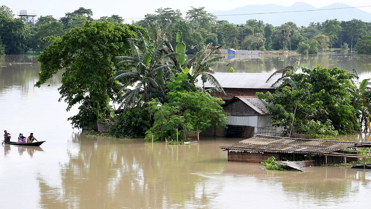
As Assam grapples with one of its worst flood disasters in decades, experts say the devastation in the state's Upper Assam region is the result of a combination of extreme rainfall, climate change and human-induced changes to the landscape that have reduced the capacity of rivers to absorb floodwaters.
The floods have claimed at least 58 lives, affected around seven lakh people across 856 villages in 12 districts and left vast stretches of Sivasagar, Charaideo and Jorhat under water. More than 1.15 lakh people are living in relief camps, while thousands have been rescued by the National Disaster Response Force (NDRF), the Army, State Disaster Response Force (SDRF), Fire and Emergency Services, and local authorities.
Chief Minister Himanta Biswa Sarma has said relief teams are yet to reach tens of thousands of people in parts of Sivasagar district because receding floodwaters have left behind several feet of sediment, making roads inaccessible.
The immediate trigger for the flooding was exceptionally heavy rainfall on 18 and 19 July in Nagaland's Mon, Mokokchung and Wokha districts and adjoining parts of Assam.
While the Assam government initially described the event as a cloudburst, meteorologists said it did not meet the India Meteorological Department's definition of rainfall exceeding 100 mm within an hour. Instead, Mon district recorded 137 mm of rainfall over eight to nine hours, triggering landslides and sending huge volumes of water downstream.
According to the Chief Minister, Charaideo recorded rainfall 436 per cent above normal, while Mokokchung received 493 per cent above normal during the period. The already swollen Brahmaputra also prevented its tributaries from draining efficiently, causing water levels to rise rapidly.
Experts say such intense rainfall events are becoming more frequent because of climate change.
Dhrubajyoti Saharia, Professor of Geography at Gauhati University, told The Indian Express that preliminary assessments suggest that excessive rainfall alone does not explain the scale of the disaster.
He said satellite imagery indicates extensive excavation along river valleys, possibly due to mining activities, which may have increased the amount of sediment flowing into rivers and reduced their carrying capacity.
Former IIT Roorkee professor Nayan Sharma, an expert in water resources and river engineering, also pointed to rapid deforestation as a major contributing factor.
He said forests slow the movement of rainwater by allowing it to infiltrate the soil, whereas barren land causes water to flow downhill rapidly, carrying large quantities of silt into rivers. The accumulated sediment raises riverbeds and reduces their ability to carry floodwaters, increasing the risk of severe flooding.
Sharma called for large-scale afforestation in watershed areas and improved flood forecasting using global precipitation monitoring systems to reduce the impact of future disasters.
Saharia also said the release of excess water from the Doyang Hydroelectric Project in Nagaland may have slowed the recession of floodwaters, although he described it as one of several contributing factors.
With large parts of Upper Assam still under water, experts say the disaster underscores how extreme weather events, coupled with environmental degradation and changing land use, are making floods more frequent and more destructive in the region.
Join our official telegram channel (@nationalherald) and stay updated with the latest headlines